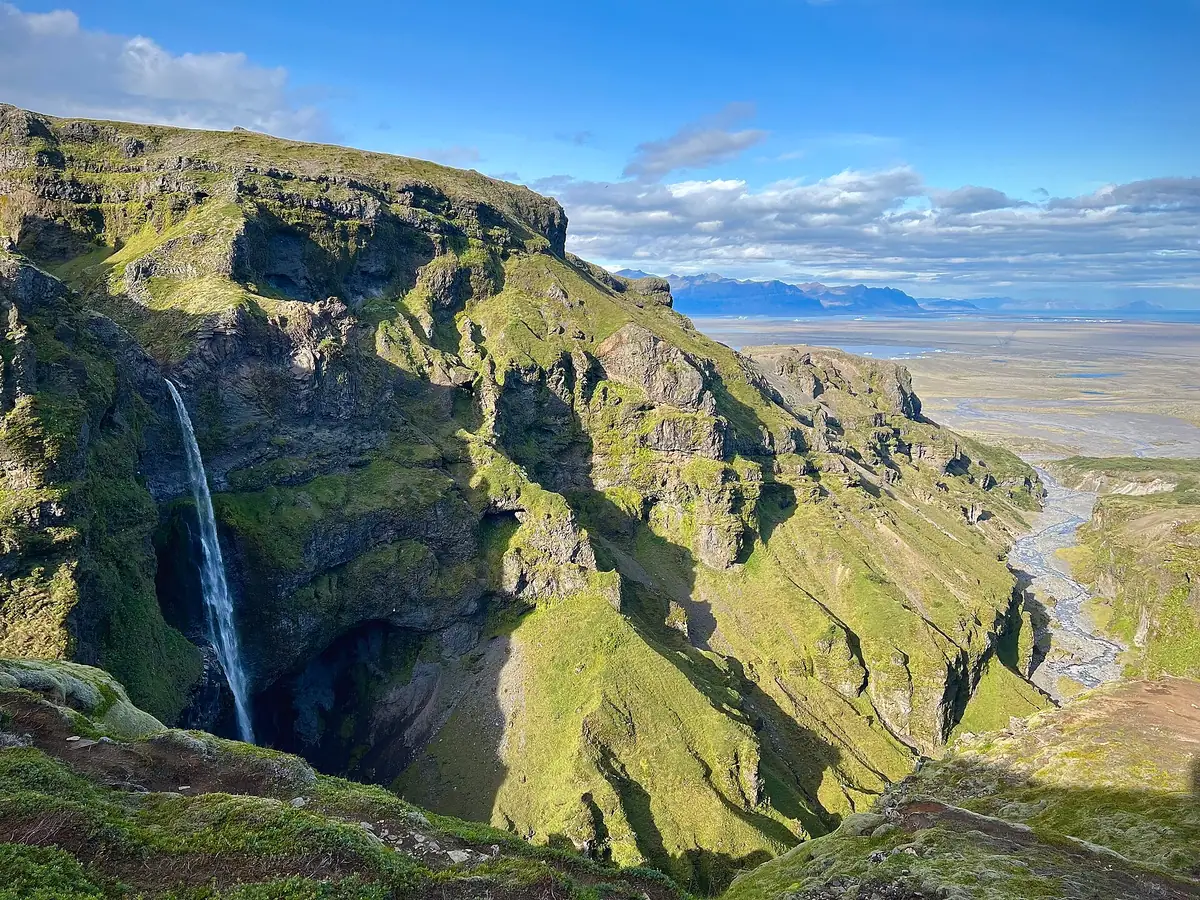
Most people who walk into Múlagljúfur come for one view: a thin white line of water falling down a green wall, with the canyon running out towards the sea behind it. That line is Hangandifoss, and it is one of the tallest waterfalls in Iceland. It is also one of the least announced. There is no sign for it on Route 1, no viewing platform and no railing. You walk to it, or you do not see it.
This note covers what the waterfall actually is, where you see it from, how it compares with the famous falls on the south coast, and how to give yourself the best chance of a good view.
What Hangandifoss is
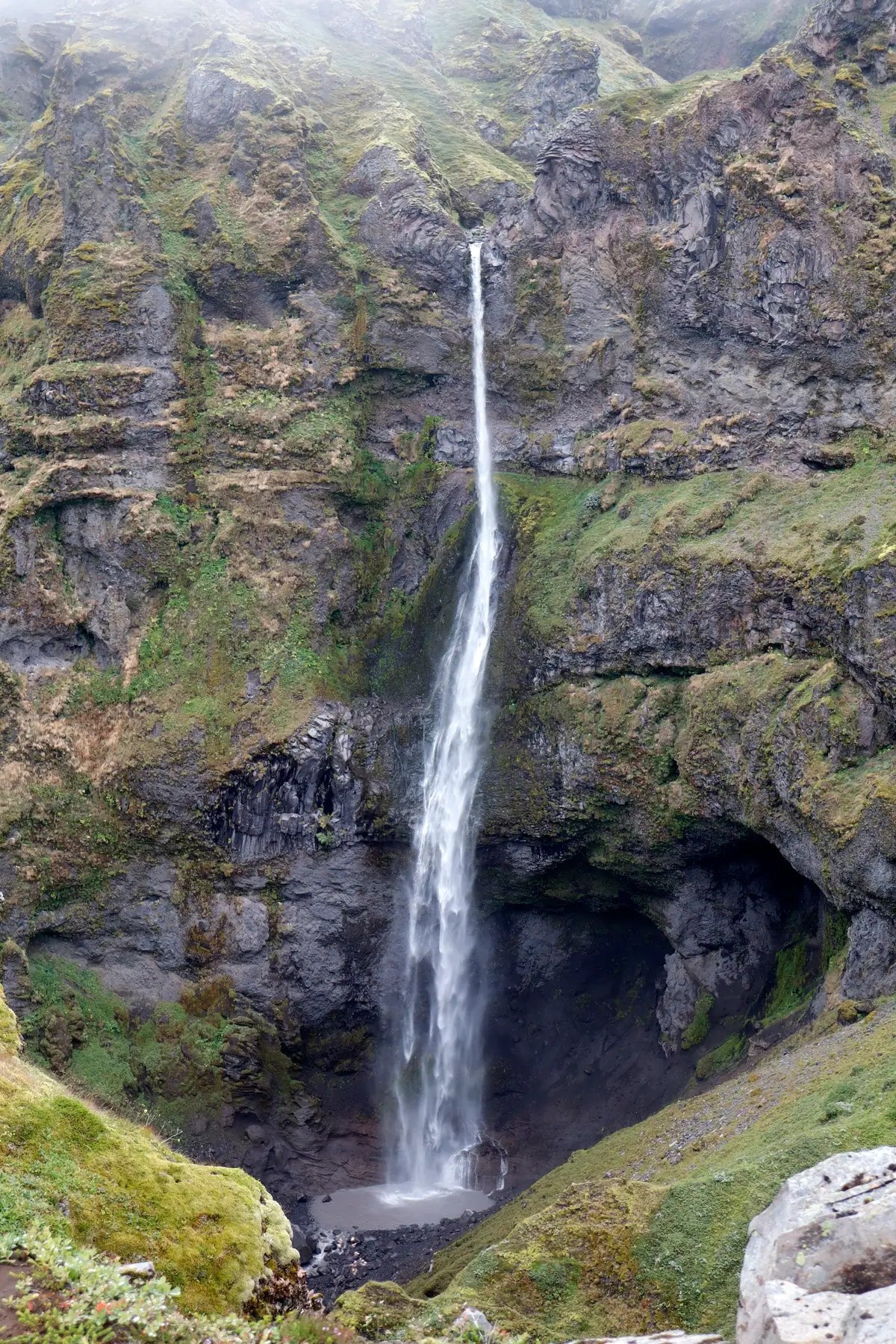
The name is plain Icelandic description. Hangandi means hanging and foss means waterfall, so Hangandifoss is the hanging fall. It is fed by a small stream, Fosslækur — the waterfall brook — which reaches the edge of the canyon high on the east wall and drops into the gorge in a single ribbon.
The height usually given is about 123 metres, and that is the figure we use on this site. You will see other numbers: some sources measure only the main free drop and arrive at around 110–120 metres, others add the lower run down to the river. The honest summary is that the main drop is well over a hundred metres, which puts it among the tallest waterfalls in the country.
What it is not is a powerful waterfall. Fosslækur is a modest stream. In a dry spell the fall thins to a thread you have to look for; after a day or two of rain it widens noticeably and the spray drifts across the face of the wall. The scale comes from the height and the setting, not from volume.

Where you see it from
You see Hangandifoss from the rim path, across the gorge. The trail never goes down to the foot of the fall; this is a waterfall you look at, not one you stand beneath.
The classic view is from the main viewpoint, about four kilometres return from the car park. Allow one and a half to two hours for that walk, plus whatever time you spend looking. From there Hangandifoss sits on the far wall with the canyon opening out towards the sandur plain and the Atlantic beyond. It is the frame most photographs of Múlagljúfur are built on, and it is a complete visit on its own.
If you continue along the upper rim, the full route is six to seven kilometres return. You get changing angles on Hangandifoss as you climb, and eventually the canyon head and Múlafoss, the second waterfall, which cannot be seen from the main viewpoint at all. The upper rim includes one narrow, exposed passage, so it is a choice for calm days and steady walkers. The hiking guide describes both routes stage by stage.
The canyon edges are unfenced the whole way. The best views of Hangandifoss come from the path itself — there is no need to step out onto moss or overhanging ground to improve the angle, and those are exactly the places that give way.
How it compares with Svartifoss and Skógafoss
People planning a south-coast trip often ask whether Hangandifoss is worth the walk when there are famous waterfalls they can reach far more easily. They are genuinely different experiences, so here is a fair comparison.
| Waterfall | Height | Getting there | Character |
|---|---|---|---|
| Hangandifoss | About 123 m | Rough hike, about 4 km return to the main viewpoint | Tall, thin ribbon in a moss-walled canyon; seen from the rim |
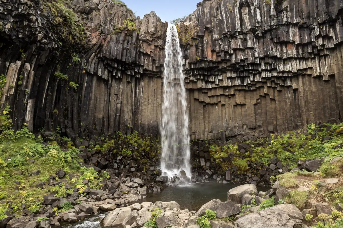
| Svartifoss | About 20 m | Marked uphill path from the Skaftafell visitor centre, roughly 1.5 km each way | Short fall framed by dark basalt columns; the path ends close to it |
| Skógafoss | About 60 m, 25 m wide | A short walk from the car park; stairs to a platform at the top | Broad, powerful curtain; you can walk close to its base |
Svartifoss is the one most visitors to this coast also see, since it is in Skaftafell, about forty kilometres west of us. It is much smaller than Hangandifoss, but the hexagonal basalt columns around it make it one of the most recognisable waterfalls in Iceland. The path is built and signed, and the walk up is shorter and gentler than ours.
Skógafoss, further west near Skógar, is a different kind of waterfall altogether: half the height of Hangandifoss but far wider and with much more water. It is right beside its car park, which means it is easy and almost always busy.
If you want power and convenience, Skógafoss wins. If you want geometry, Svartifoss. Hangandifoss is the one for height, setting and quiet — a long ribbon of water in a green gorge that you have walked to, usually with only a handful of other people around. We would not tell anyone to skip the other two. They are on the way, and seeing all three gives you a good sense of how different Iceland's waterfalls can be.

Getting the best view
Hangandifoss is at its most impressive after rain, when the flow is fuller and the moss is darkest. That is also when the path is wettest, so it is a trade-off; read what the trail is like underfoot before you choose a wet day.
- Season. May to September is the practical season. July is the greenest; August into early September usually balances weather, colour and crowds best.
- Time of day. Early morning and evening at the canyon are often close to empty, while tour traffic clusters around midday on the lagoon run. The fall drops off the east wall, which faces west across the gorge, so it tends to catch direct sun later in the day.
- Cloud. Low cloud often sits on the canyon rim. That can hide the top of the fall, but a lifting fog also gives some of the most atmospheric views of the day. If the cloud is right down at the viewpoint, waiting half an hour sometimes changes everything.
- Lens. The fall is tall and narrow and you see it across a gorge, so a portrait frame or a modest zoom does more than an ultra-wide. Overcast light is kind to waterfalls; you do not need sunshine for a good photograph.
Fulmars nest on the canyon walls from May into August, and they abandon ledges when disturbed. Keep drones grounded near the cliffs in nesting season, and check the official drone rules before planning any flight.
- Hangandifoss is about 123 m high and is seen from the rim, not from its base.
- The classic view is at the main viewpoint, about 4 km return, 1.5–2 hours.
- Múlafoss, the second fall, needs the full rim route (6–7 km return).
- There is no sign on Route 1 — set the parking coordinates before you set off.
Directions, parking and the turn-off at the camera gate are on Plan your visit, and the story of how the canyon and its two waterfalls formed is on The canyon. If you are combining the walk with Skaftafell and the lagoons, see one day on the Öræfi coast and our guide to the area.